Property Record
Sandycreek Rd, , GA


Save to a Folder
{{folder.Name}}
{{folder.ListingIds.length}} Properties
{{folder.ListingIds.length}} Property
Create a New Folder
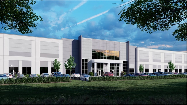
Property Detail
Sandycreek Rd
07-25-00-014
TRACT 7 43.91 ACRES
Commercialnec
FAYETTE
C OI
Georgia
B and X Area of moderate flood hazard, usually the area between the limits of the 100-year and 500-year floods.
43.90 AC
2024
Fayette/Coweta County
2025
Atlanta
140204
Atlanta-Sandy Springs-Roswell, GA
1,166 SF
NEARBY LISTINGS FOR SALE OR LEASE
DEMOGRAPHICS near Sandycreek Rd
1 mile
3 mile
5 mile
2025 Total Population
1,647
17,456
52,727
2030 Population
1,705
18,215
54,877
Pop Growth 2025-2030
+ 3.52%
+ 4.35%
+ 4.08%
Average Age
41
39
40
2025 Total Households
521
6,098
19,252
HH Growth 2025-2030
+ 3.65%
+ 4.18%
+ 3.94%
Median Household Inc
$114,583
$100,425
$95,753
Avg Household Size
3.10
2.80
2.70
2025 Avg HH Vehicles
2.00
2.00
2.00
Median Home Value
$440,500
$378,419
$406,718
Median Year Built
1998
1999
2000
Nearby Places
Map Layers
Map Styles
 Street
 Aerial
Layers
 Traffic
 Biking
Places
Listings with unknown addresses are not visible on the map
- Restaurants
- Banks
- Shops
- Fitness
- Groceries
PUBLIC TRANSPORTATION
AIRPORT
Hartsfield - Jackson Atlanta International
Drive
Walk
Distance
Hartsfield - Jackson Atlanta International
25 min
17.1 mi
Freight Ports
Georgia Ports - Savannah
Drive
Walk
Distance
Georgia Ports - Savannah
287 min
254.4 mi
SALE & LEASE HISTORY
LISTING DATE
SALE/LEASE

Feb 14, 2023
For Lease
Nearby Properties
Address
Land Use
TOTAL SIZE
Lot Size
Zoning
Address
Land Use
TOTAL SIZE
Lot Size
Zoning
1,511,212 SF
19.33 AC
M1
Address
Land Use
TOTAL SIZE
Lot Size
Zoning
1,160,240 SF
71.94 AC
AG1
Address
Land Use
TOTAL SIZE
Lot Size
Zoning
907,675 SF
73.12 AC
AG1
Address
Land Use
TOTAL SIZE
Lot Size
Zoning
1,102,504 SF
24.79 AC
A
Address
Land Use
TOTAL SIZE
Lot Size
Zoning
1,127,500 SF
89.15 AC
M1
Address
Land Use
TOTAL SIZE
Lot Size
Zoning
1,040,000 SF
74.64 AC
AG1
Address
Land Use
TOTAL SIZE
Lot Size
Zoning
831,160 SF
17.53 AC
C2
Address
Land Use
TOTAL SIZE
Lot Size
Zoning
873,600 SF
65.24 AC
C2
Address
Land Use
TOTAL SIZE
Lot Size
Zoning
412,253 SF
134.50 AC
Address
Land Use
TOTAL SIZE
Lot Size
Zoning
1,271,815 SF
26.11 AC
C1
Address
Land Use
TOTAL SIZE
Lot Size
Zoning
1,050,936 SF
26.33 AC
C1
Address
Land Use
TOTAL SIZE
Lot Size
Zoning
556,800 SF
32.69 AC
M1
Address
Land Use
TOTAL SIZE
Lot Size
Zoning
384,305 SF
15.26 AC
MIX
Address
Land Use
TOTAL SIZE
Lot Size
Zoning
498,274 SF
24.34 AC
MIA
Address
Land Use
TOTAL SIZE
Lot Size
Zoning
510,180 SF
41.23 AC
M1
Address
Land Use
TOTAL SIZE
Lot Size
Zoning
491,992 SF
48.25 AC
M1
Address
Land Use
TOTAL SIZE
Lot Size
Zoning
420,000 SF
23.69 AC
MIA
Address
Land Use
TOTAL SIZE
Lot Size
Zoning
317,520 SF
29.74 AC
M1
Address
Land Use
TOTAL SIZE
Lot Size
Zoning
163,142 SF
234.58 AC
M1
Address
Land Use
TOTAL SIZE
Lot Size
Zoning
350,000 SF
17.54 AC
M1
Address
Land Use
TOTAL SIZE
Lot Size
Zoning
417,540 SF
20.73 AC
M1
Address
Land Use
TOTAL SIZE
Lot Size
Zoning
394,181 SF
50.13 AC
M1A
Address
Land Use
TOTAL SIZE
Lot Size
Zoning
297,976 SF
18.83 AC
MIA
Address
Land Use
TOTAL SIZE
Lot Size
Zoning
10.32 AC
MIA
Address
Land Use
TOTAL SIZE
Lot Size
Zoning
294,500 SF
37.91 AC
M1A
Address
Land Use
TOTAL SIZE
Lot Size
Zoning
242,550 SF
15.82 AC
AG1
Address
Land Use
TOTAL SIZE
Lot Size
Zoning
2,875,620 SF
22.05 AC
AG1
Address
Land Use
TOTAL SIZE
Lot Size
Zoning
80,800 SF
9.39 AC
C C2
Address
Land Use
TOTAL SIZE
Lot Size
Zoning
598,814 SF
120.60 AC
Address
Land Use
TOTAL SIZE
Lot Size
Zoning
80,956 SF
60.90 AC
The World's #1 Commercial Real Estate Marketplace
Connect with us
© 2026 CoStar Group
The information above has been obtained from sources believed reliable. While we do not doubt its accuracy we have not verified it and make no guarantee, warranty or representation about it. It is your responsibility to independently confirm its accuracy and completeness. Any projections, opinions, assumptions, or estimates used are for example only and do not represent the current or future performance of the property. The value of this transaction to you depends on tax and other factors which should be evaluated by your tax, financial, and legal advisors. You and your advisors should conduct a careful, independent investigation of the property to determine to your satisfaction the suitability of the property for your needs.